Constantinois - cartes : Différence entre versions
(→Cartes au 1/50.000) |
|||
| Ligne 25 : | Ligne 25 : | ||
<gallery> | <gallery> | ||
| + | Image:Akbou_1935.jpg|Akbou 1935 1/50.000 | ||
| + | Image:Blandan_1929.jpg|Blandan 1929 1/50.000 | ||
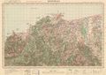
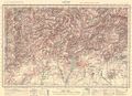
Image:bone_1929.jpg|Bône 1929 1/50.000 | Image:bone_1929.jpg|Bône 1929 1/50.000 | ||
| + | Image:Bordj_Bou_Arreridj_1935.jpg|Bordj Bou Arréridj 1935 1/50.000 | ||
Image:Bougie_1935.jpg|Bougie 1935 1/50.000 | Image:Bougie_1935.jpg|Bougie 1935 1/50.000 | ||
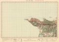
Image:Cap_Bougaroun_1911.jpg|Cap Bougaroun 1911 1/50.000 | Image:Cap_Bougaroun_1911.jpg|Cap Bougaroun 1911 1/50.000 | ||
| Ligne 34 : | Ligne 37 : | ||
Image:La_Calle_1930.jpg|La Calle 1930 1/50.000 | Image:La_Calle_1930.jpg|La Calle 1930 1/50.000 | ||
| − | Image:Le_Khroub_1925.jpg|Le Khroub 1925 | + | Image:Le_Khroub_1925.jpg|Le Khroub 1925 1/50.000 |
Image:Philippeville_1928.jpg|Philippeville 1928 1/50.000 | Image:Philippeville_1928.jpg|Philippeville 1928 1/50.000 | ||
| − | Image:Saint_Arnaud_1927.jpg|Saint Arnaud 1927 | + | Image:Saint_Arnaud_1927.jpg|Saint Arnaud 1927 1/50.000 |
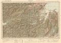
| − | Image:Setif_1929.jpg|Sétif 1929 | + | Image:Setif_1929.jpg|Sétif 1929 1/50.000 |
Version du 25 octobre 2013 à 16:35
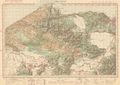
Cartes générales

Plans de villes
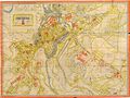
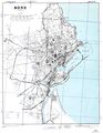
Bône 1887
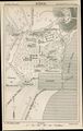
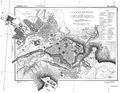
Constantine 1887
Constantine 1951


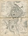
Plans de 1942
Plans annotés par l'US Army en vue du débarquement en AFN
Bône
Bougie
Constantine
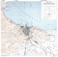
Philippeville


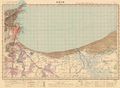
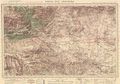
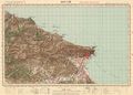
Cartes au 1/50.000
Akbou 1935 1/50.000
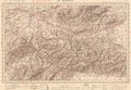
Blandan 1929 1/50.000
Bône 1929 1/50.000
Bordj Bou Arréridj 1935 1/50.000
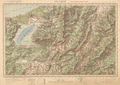
Bougie 1935 1/50.000
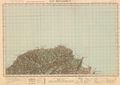
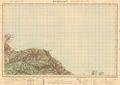
Cap Bougaroun 1911 1/50.000
Cap de Fer 1928 1/50.000
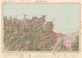
Collo 1911 1/50.000
Djidjelli 1927 1/50.000
Herbillon 1928 1/50.000
La Calle 1930 1/50.000
Le Khroub 1925 1/50.000
Philippeville 1928 1/50.000

Saint Arnaud 1927 1/50.000
Sétif 1929 1/50.000


